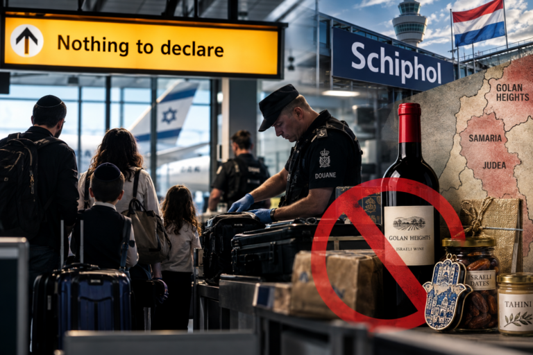
I have spent most of my working life looking at photographs and asking a fairly basic question: what does this picture actually prove?
That question came back to me this week when I saw the extraordinary new satellite images of Gaza appearing across the media.
The Independent reported that Google Earth had “exposed” the devastation. El País produced a striking before-and-after presentation allowing readers to move across Gaza and compare neighborhoods before the war with Google’s latest imagery.
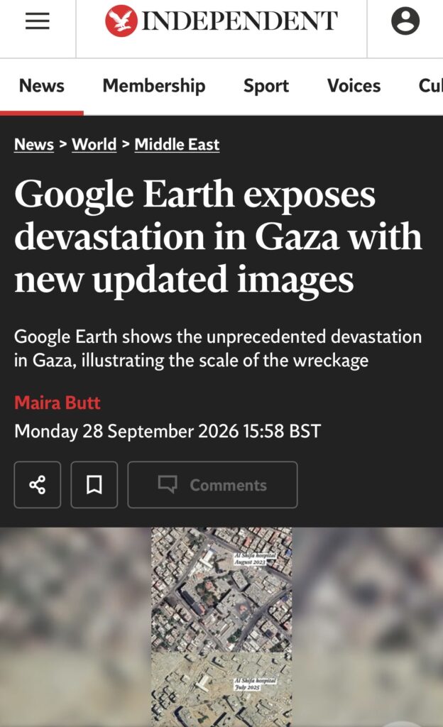
The pictures are remarkable.
Whole neighborhoods have changed beyond recognition. Buildings have disappeared. Roads cut through areas that were once densely built. Large sections of Rafah, Khan Younis and northern Gaza are rubble. Nobody looking at these images can sensibly dispute the enormous physical destruction.
But a satellite photograph has the same limitation as every other photograph.
It can only show what is inside the frame.
And in this case, the frame stops at ground level.
That is particularly relevant in Gaza.
Take Tel al-Sultan in Rafah. It features prominently in the new El País comparison, where the latest satellite image shows an area almost completely destroyed.
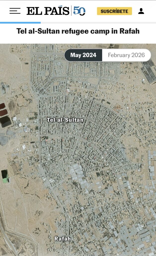
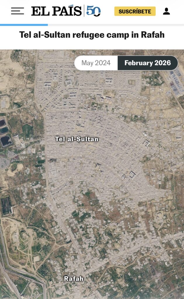
Now come back down to earth.
In September 2024, Reuters reporters were taken by the Israeli military into Tel al-Sultan. There they were shown the entrance to a tunnel in what appeared to have been a child’s room inside a destroyed house.
Around 20 meters underneath them was the tunnel where six Israeli hostages had been held and killed by Hamas. The IDF said it formed part of a recently uncovered 13-kilometer underground network. Reuters reported what its journalists were shown while appropriately attributing the wider claims to the Israeli military.
Look at Tel al-Sultan from Google’s satellite, and you cannot see any of that.
That doesn’t prove why the buildings above were destroyed. I don’t know, from those satellite pictures, how many buildings were destroyed because of tunnels, fighting, airstrikes, bulldozing, the creation of military corridors or something else.
Neither does Google.
Six months ago, I wrote about precisely this problem in my Photo Bias investigation, “Reconstructing Minab: How Media ‘Verified’ the Iran School Strike Without Independent Access.”
With journalists unable to reach the site of the reported school strike in Iran, news organizations increasingly relied on satellite photographs, geolocation, video, and official statements to reconstruct events remotely.
I called it the “verification pivot.”
Satellite imagery can be extraordinarily useful. In Minab, it could establish location and visible physical damage. It couldn’t identify victims, independently establish casualty figures or reconstruct everything that had happened on the ground.
Now we are looking down at Gaza.
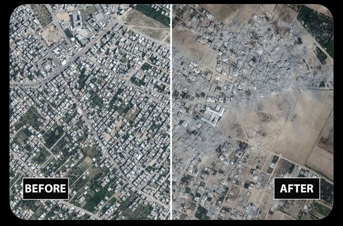
The technology has improved enormously. The limitation hasn’t.
A before-and-after slider is visually devastating because it appears so simple. Here was a neighborhood. Move the slider. Now it is rubble.
The picture has established the physical change.
The explanation still requires journalism.
That means examining individual military operations, Hamas infrastructure, tunnels, fighting, demolitions, civilian harm and the circumstances surrounding particular locations. Sometimes those answers will be deeply uncomfortable for Israel. Sometimes they may provide military context that isn’t visible from orbit.
A satellite cannot make that judgment for us.
As an imagery analyst, I find the new Google pictures enormously valuable. I also know where their evidentiary value ends.
They can show us what happened to the surface of Gaza.
The trouble with looking at Gaza from space is you can’t see underground.
Liked this article? Follow HonestReporting on Twitter, Facebook, Instagram and TikTok to see even more posts and videos debunking news bias and smears, as well as other content explaining what’s really going on in Israel and the region. Get updates direct to your phone. Join our WhatsApp and Telegram channels!
© Divuach Ne’eman R”A, 2025