I’m tired of reading about eastern Jerusalem. It’s time to see what’s going on.
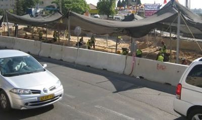
For my traveling convenience, this morning’s walk begins along Highway One, where the municipality is building a light rail system, running as far north as Shuafat and Pisgat Zeev.
This particular stretch is being built along the highway, which, from 1948-1967, was no man’s land between Jerusalem’s Israeli and Jordanian sectors. Prior to the 1948 War of Independence, the city had never been divided, so the concept of an “East” and West” Jerusalem is relatively new.
Here, the Israeli Antiquities Authority is excavating along the path of the tracks before construction begins.
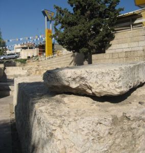
I haven’t seen news reports of any finds. But at the nearby Shmuel HaNavi neighborhood, archaeologists discovered a Roman-era quarry, which was part of a network of quarries around Jerusalem.
One such quarry is adjacent to the US consulate in Bab Az-Zahra, a two minute walk from where I am.
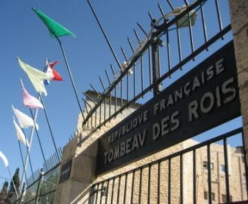
I continue down Nablus Rd till I arrive at the Tomb of the Kings. No kings were ever buried here, but it’s widely believed that that one of several sarcaphogi found here belonged to Queen Helena of Adiabene, who converted to Judaism around 30 C.E.
The site currently belongs to the French government. I later learn that I might have been allowed to enter the grounds had I but banged on the gate loudly enough.
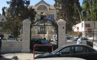
The Sheikh Jarrah/Shimon Hatzaddik neighborhood is a short walk from here, but I wanted to first make a quick stop at the Orient House.I don’t know the building’s official (or unofficial) status now, so I had no expectations of what I’d find; I can’t explain what I did see.
Behind the wall, were parked several white vehicles, all clearly labeled UN. At the top of the steps leading into the building was a blue flag loosely tied up; I presume it was a UN flag. Two men were standing in the parking lot, and a third guarded the entrance door itself atop the steps. When they saw me getting ready to take a picture, one of the two men told me photographs were forbidden and began walking towards me –though not in an overtly hostile way.
I left, but doubled back and managed to get one photo before someone else — the man in the foreground — yelled across the street that photos are forbidden. This is the only picture I managed to take.
The Orient House was last in the news in 2007, when Mahmoud Abbas said he wanted it reopened. Israel shut down the building as the PA’s Jerusalem office immediately after the 2001 Sbarro’s suicide bombing when 15 people were killed.
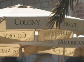
On my way down to Sheikh Jarrah/Shimon HaTzaddik, I passed the American Colony Hotel. It’s the hotel of choice for foreign journalists — making it ground zero for media groupthink in Israel and opportunistic Palestinian fixers. A quick photo and off I go.
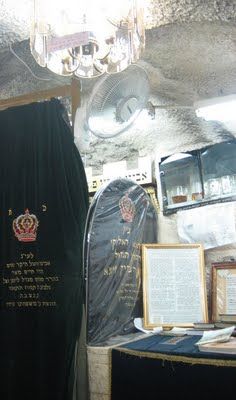
Continuing down Nablus Rd., I see a sign pointing the way to the tomb of Shimon HaTzaddik, perhaps the last truly great High Priest of the second temple period. He’s quoted in Ethics of Our Fathers, appeared to Alexander the Great before battles, and was one of the last members of the Great Assembly.
His cave is blissfully air conditioned, and there’s no shortage of long-life, low-energy bulbs in the light fixtures affixed to the stone walls and uneven ceiling. A sign warns kohanim, (Jews who descend from the priestly family), not to pass by a certain point for reasons of ritual purity. It’s well after the normal time for morning prayers, but two latecomers quietly rock back and forth in front of the green and gold cenotaph. Nearby, four men sit silently immersed in study.
Above the cave lies Nahalat Shimon, a tidy, if somewhat ramshackle compound where a handful of families live. A string of little Israeli flags flutters over a playground, all under the watchful eye of a guard at the compound’s upper entrance on Nablus Rd. where I exit.
The nearby Shimon HaTzadik neighborhood was originally established in 1891, but fell to Jordan in 1948. Jews returned after Jerusalem’s 1967 reunification.
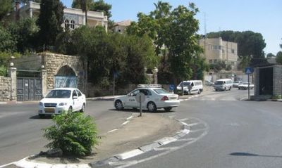
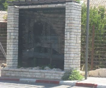
Looking around to get my bearings, I realize I’m close to the top of Sheikh Jarrah when I spot a monument standing at the side of the junction where Nablus Rd. suddenly veers left and also connects to the Mt. of Olives Rd on the right.
Why the monument?
It was at this hairpin turn — also known as the Nashashibi Bend– where Arabs ambushed a Hadassah medical convoy going up to the Mt. Scopus hospital. It was a massacre by any standards: 79 doctors and nurses, and Haganah escorts were killed.
The monument is at the right of the photo. The taxi is turning left onto the continuation of Nablus Rd.
The monument is so close to the street I didn’t feel safe standing in front of it for any length of time as cars passed awfully close behind me. The junction gave me the creeps; it was indeed the perfect place for an ambush.
Bearing to the right, I continue up the hill following the Mt. of Olives Rd. I soon find myself across the street from the British consulate. A Union Jack lists from the top of a proud flagpole; on the dusty driveway, security guards loiter between the front gate and heavy concrete planters from which small flowers add a touch of color.
I know I’m very close the Shepherd’s Hotel: the British consulate made the first fuss, bringing the project to Washington’s disapproving attention — Jews are moving into their neighborhood now. I follow the curve in the road, and see the Shepherd Hotel.
And it’s not much to look at.
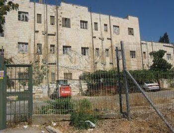
This nondescript building sits in a lot surrounded by parched brown grass, dirt, rocks and a few trees. In better days, it housed a Border Police station, but they moved into a newer building on Highway One. A car and a Bobcat construction vehicle are parked outside the building.
The building itself was originally built in the 1930s for the Mufti of Jerusalem, local leader of Palestinian nationalism and Nazi sympathizer, Haj Amin al-Husseini. If there were any workers (or protesters), I was evidently too early. I didn’t see a single soul.
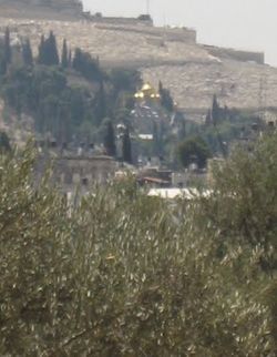
Across the street lay a field of olive trees with a nice view of Mt. Scopus and the Mt. of Olives. This area also belonged to the mufti and is known as the Mufti’s Vineyards.
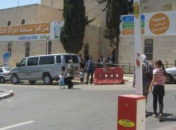
Following the road a little further takes me to a traffic circle and a wider, more modern road leading in the general direction of Mt. Scopus. To the left of the traffic circle, is a government district named after Menachem Begin, including a police station and a few ministries. On my side of the street, is the Sheikh Jarrah Health Center, where I hope to find a water fountain and refill my bottle.
Outside the center, cars — mostly Subarus like you see around the Jerusalem — with yellow license plates vie for limited parking spaces. Inside, I find a modern, clean building no different from other medical centers around town. Signs in Arabic and Hebrew direct people to the appropriate areas for hearing tests, ultrasounds, pediatrics, blood tests, physiotherapy, etc.
No wonder renewed talk of dividing Jerusalem sparks an increase in Palestinians seeking Israeli citizenship. Nobody wants to lose access to Israeli health care and other social benefits.
After refilling my bottle, I find a chair where I pause to enjoy the air conditioning.

